To cover the world, to cross it in every direction, will only ever be to know a few square meters of it… tiny incursions into disembodied vestiges, small incidental excitements, improbable quests congealed in a mawkish haze a few details of which will remain in our memory. And with these, the sense of the world is concreteness…no longer as a journey having constantly to be remade, nor the illusion of a conquest, but as the rediscovery of a meaning, the perceiving that the earth is a form of writing, a geography of which we had forgotten that we ourselves are the authors.
Georges Perec, Species of Spaces
PDPal is an ongoing series of public art projects for the Palm™ PDA, mobile phone and the web. It has pushed at the notion of mapping, attempting to transform your everyday activities and urban experiences into a dynamic city that you write. PDPal engages the user sthrough a visual transformation that is meant to highlight the way technologies that locate and orient are often static and without reference to the lively nature of urban cultural environments.
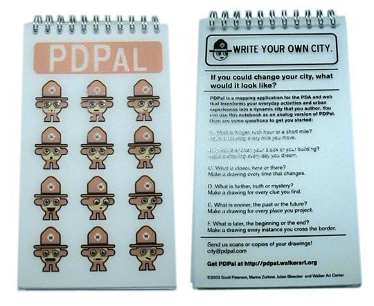
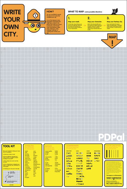
Your own city is the city composed of the places you live, play, work, and remember. Itís made of the routes and paths through which you make connections. Your city is also about the meanings you ascribe to the places you inhabit, pass through, love or hate. You imagine those places and routes as more than a street address, or directions you may give. These places have vivid, metaphorical meanings and histories that PDPal allows you to capture and visualize imaginatively, effectively writing your imaginary city.
In response to the plethora of mapping projects that have utilized GPS and measurable cartography, PDPal has been anti-geographic and anti-cartesian, preferring to experiment with the construction of relative, emotionally based systems that ask: what makes social or personal space. PDPal responds to the century-old idea of the urban explorer: from Baudelaire’s “flaneur” (late 19th c); the Dadaists’ public performances of nothing, sometimes called “deambulations” (1921); Benjamin’s texts on the urban wanderer (1920’s); the Situationists’ algorithmic “derives”; Hakim Bey’s “Temporary Autonomous Zones” that spring up in the cracks of urban regulations, and are opportunities for brief piracy of a place; and contemporary work in psychogeography – all deliberate projects of “getting lost” in the city, thus restoring it to a great dense space of wonder, not just a locus of labors.
Project History
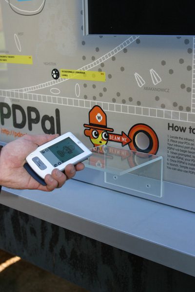
Presented at Eyebeam Atelier in New York. In this first version of PDPal, a user beamed an app to their PDA from the installation, much resembling a bus shelter with a two-sided duratrans. The user would input criteria about their social, tactile, weather, and speed conditions, and the PDA app would return a pictographic “haiku.” there was further room for a short text annotation. Users could share these haiku” by beaming them to one another.
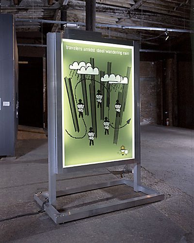
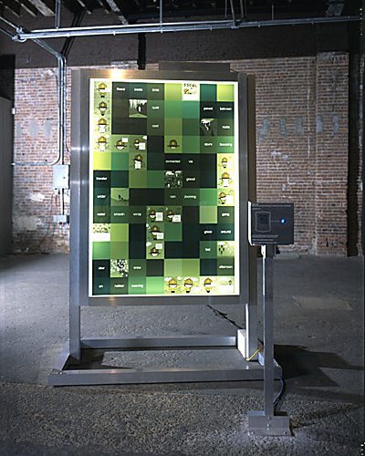
Commissioned by the Walker Art Center through its EAEM3 grant, a PDPal kiosk was installed in the Minneapolis Sculpture Park for Summer 2003. This and the following iterations did away with the application-generated pictograms, designing instead a complete cartographic system of ‘stickies,’ pictographic symbols, and parameters by which a user could map their own city, with or without the Cartesian grid. The kiosk contained a beam-able PDA application, through which users could map the sculpture park, and after hot syncing their PDA to their computer, could upload the data to a web site. The web site was more extensive, allowing users to map Minneapolis and parts of St. Paul.
Installation Documentation
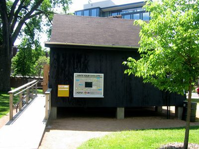
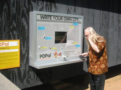
PDPal was part of the”Twin Cities Knowledge Maps” commissioned by the University of Minnesota Design Institute in 2003. Nine large interpretive maps were printed, offering views of Minneapolis/St. Paul on the themes of MOVING, WEARING, TELLING, RESTING, PLAYING, DWELLING, EATING, SHOPPING and MEETING. PDPal functioned as experimental documentary, using symbols and short anecdotes to reflect diverse daily paths through the metropolis. On the reverse side, a user could write their own city, using PDPal’s recording system and a set of pictographic stickers.
KNOWLEDGE MAP IMAGES

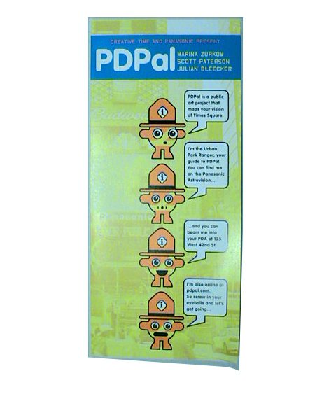
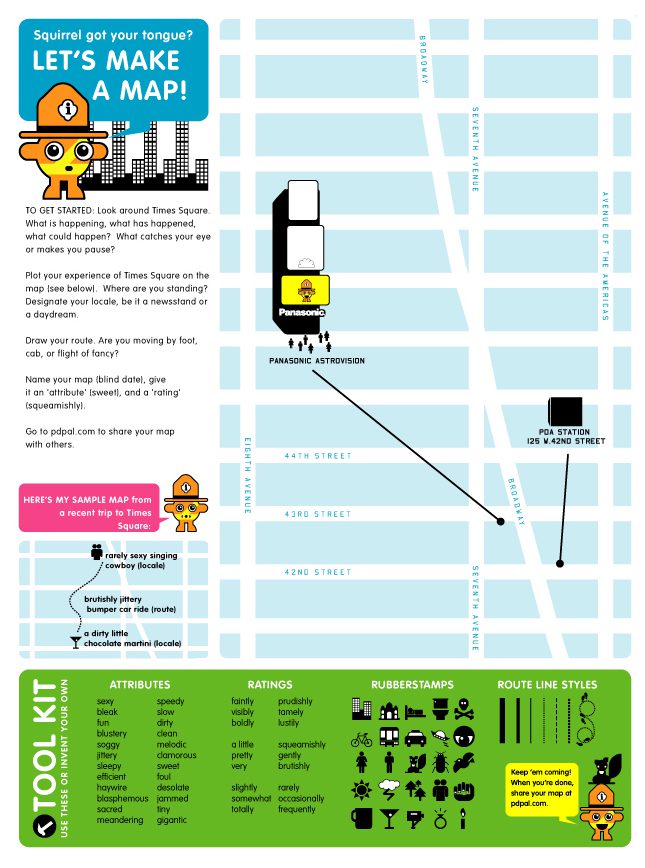
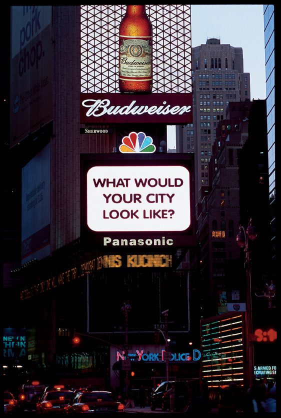
Commissioned by Creative Time in New York, PDPal appeared in Times Square in the Fall/Winter of 2003/2004. PDPal had three components:
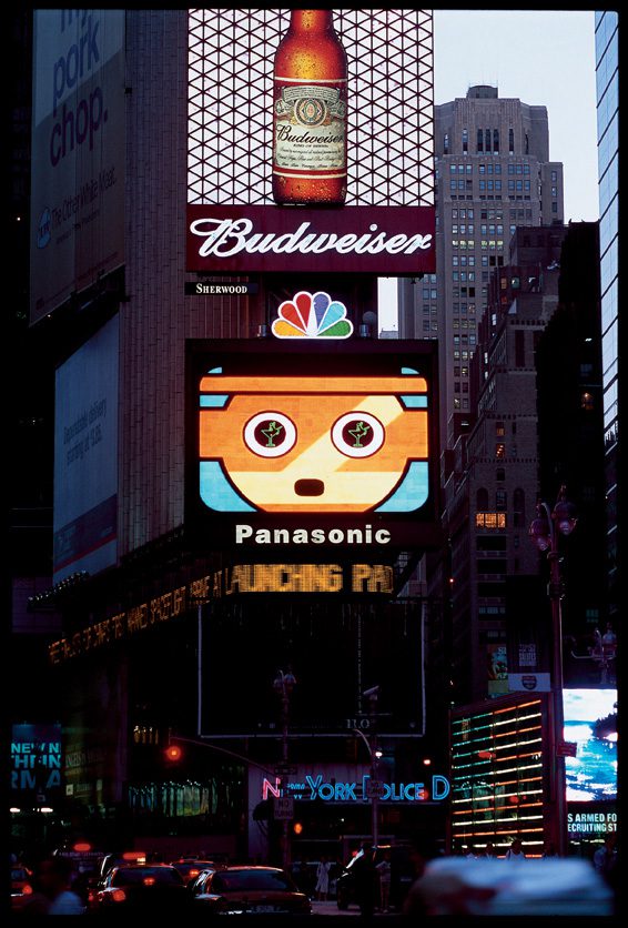
– Once every hour, a 1-minute movie was broadcast on the Panasonic Astrovision board as part of Creative Time’s “59th Minute” series
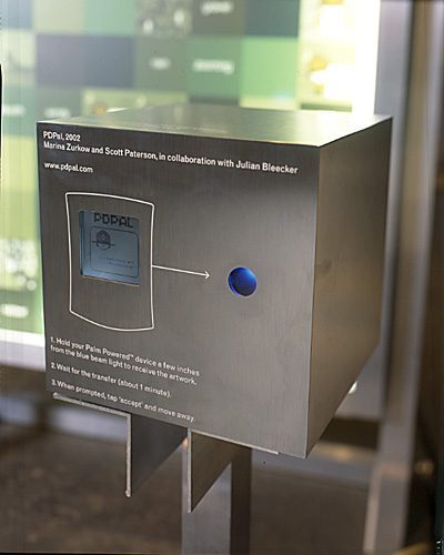
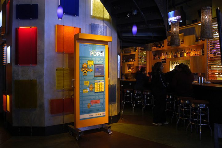
– Two kiosks, one stationary and one that moved monthly, were stationed in the Times Square area. Each kiosk contained a graphic of Times Square and a beaming box that contained the PDA application. Participants could beam the app to their PDA in order to map Times Square.
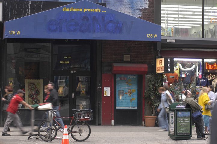
– Two scheduled “walkabouts” were performed by the PDPal team, Creative Time, and participants. People convened at Chashama Theater in Times Square, broke up into teams, and carried out mapping missions in the area for an hour. we all then reconvened to share our map/narratives. Missions were either to be an alien anthropologist, carry out an algorithmic walk, or investigate a documentary aspect of the area. Glowlab participated in the first walkabout; click here for their report.
Brochure
Installation Documentation
To describe space: to name it, trace it…Space as inventory, space as invention.
Georges Perec, “Species of Spaces”
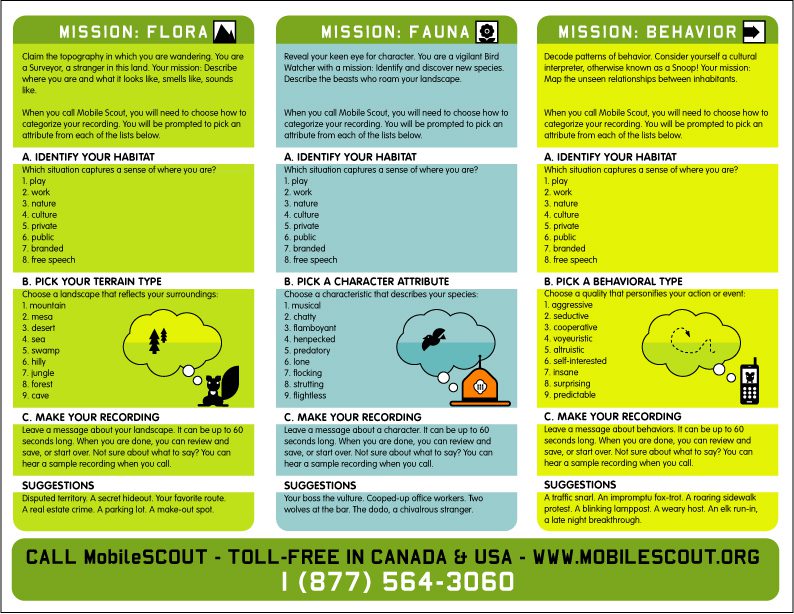
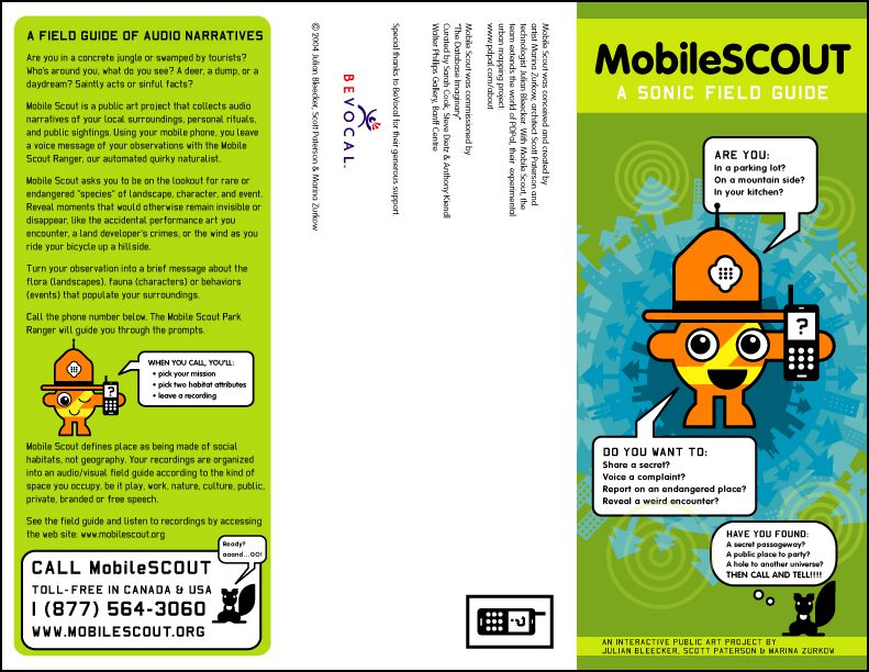
PDPal’s third iteration, called Mobile Scout, is an audio field guide, collecting phoned-in narratives of one’s local surroundings, personal rituals, and public sightings. Using your mobile phone, you leave a voice message of your observations with the Mobile Scout Ranger, our automated quirky naturalist.
Mobile Scout asks you to be on the lookout for rare or endangered species of landscape, character, and event, revealing moments that would otherwise remain invisible or disappear, like the accidental performance art one encounters, a land developer’s crimes, or the wind as you ride your bicycle up a hillside.
Mobile Scout defines place as being made of social habitats, not geography. Your recordings are organized into an audio/visual field guide according to the kind of space you occupy, be it play, work, nature, culture, public, private, branded or free speech.
Mobile Scout will be presented in the upcoming exhibition “Database Imaginary” curated by Steve Dietz, Sarah Cook and Anthony Kiendl. Originating at the Walter Philips Gallery at the Banff Centre, Alberta, Canada, the exhibit will tour Canada and Europe in 2005-06.