Research Journal
-
August 8, 2013
Superfund > < supernova?

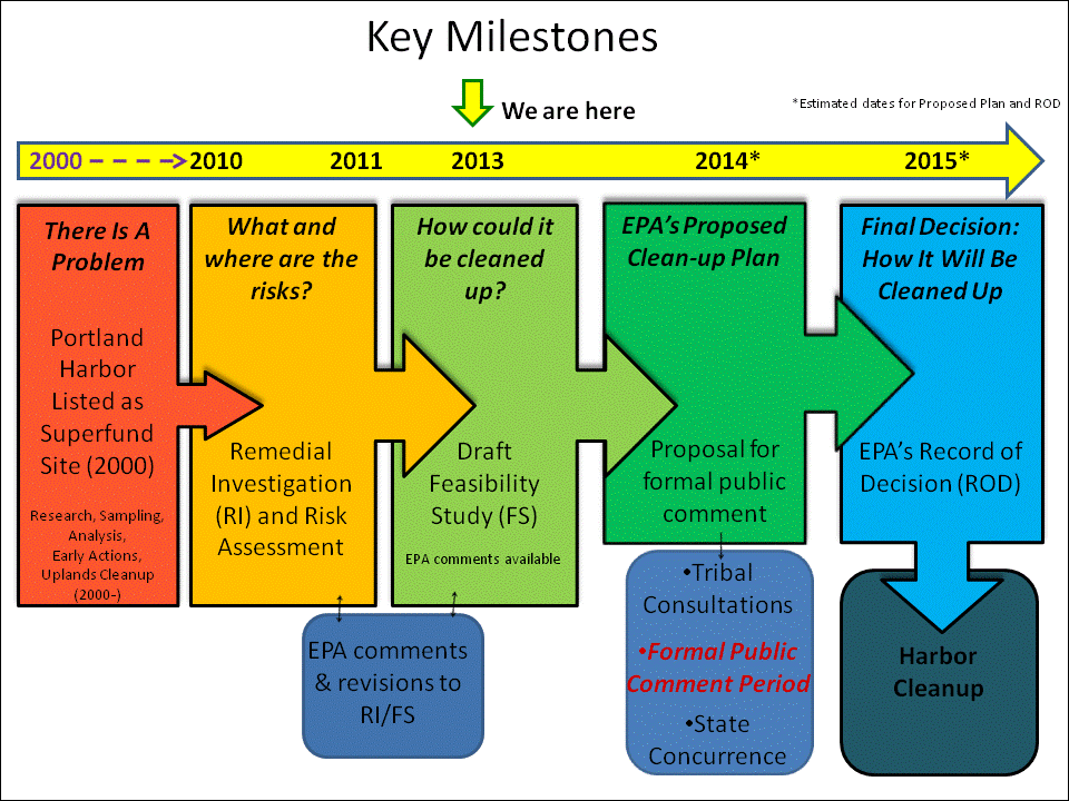
A Superfund site is an abandoned hazardous waste site that poses enough risk to human and environmental health that the Environmental Protection Agency has stepped in to lead a clean-up effort. It’s also the name of an actual fund that no longer has any money in it*
– http://www.epa.gov/superfund/about.htm
This Chandra X-ray photograph shows Cassiopeia A (Cas A, for short), the youngest supernova remnant in the Milky Way.
Credit: NASA/CXC/MIT/UMass Amherst/M.D.Stage et al.A blindingly bright star bursts into view in a corner of the night sky — it wasn’t there just a few hours ago, but now it burns like a beacon. That bright star isn’t actually a star, at least not anymore. The brilliant point of light is the explosion of a star that has reached the end of its life, otherwise known as a supernova.
Supernovas can briefly outshine entire galaxies and radiate more energy than our sun will in its entire lifetime. They’re also the primary source of heavy elements in the universe.
https://en.wikipedia.org/wiki/Supernova
* the Superfund law originally paid for toxic waste cleanups through a tax on petroleum and chemical industries. The chemical and petroleum fees were intended to provide incentives to use less toxic substances. Over five years, $1.6 billion was collected, and the tax went to a trust fund for cleaning up abandoned or uncontrolled hazardous waste sites. The last full fiscal year (FY) in which the Department of the Treasury collected the tax was 1995. At the end of FY 1996 the invested trust fund balance was $6.0 billion. This fund was exhausted by the end of FY 2003; since that time funding for superfund sites for which the potentially responsible party (PRP) could not be found has been appropriated by Congress out of general revenues. –http://en.wikipedia.org/wiki/Superfund#Provisions


-
August 7, 2013
Portland Harbor Superfund site info
SO tempting to call it superfun/d, but the marvelous Christie Leece with her Superfund Salvage oh so subtly or accidentally came to a similar etymological epiphany already.
Look:
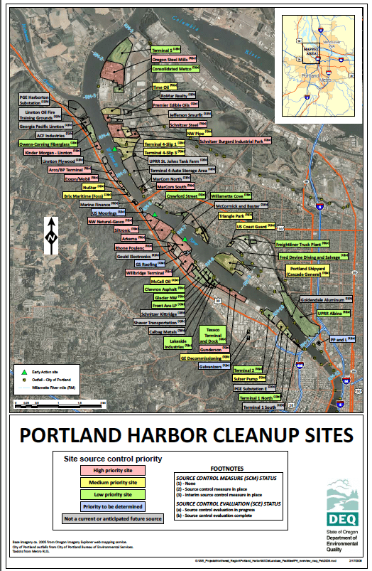
Interactive map (must use firefox) -
August 7, 2013
AS FOR THE CLAY…
As for the clay, now I am teaching myself how to process it. I’m using the best online explanation I could find here.
So first, yeah, I found some clay. I was simply excited to touch the stuff and recognize it as clay: silky, powdery, and if you wet it and rubbed it between your fingers, you could tell, if you’d ever handled slip in a cushy predetermined amateur clay studio like the one I work in in Brooklyn. I’m not good at assessing clay yet; apparently you should roll the clay in question between your palms and if it turns into a worm, it’s good whereas if it falls apart or smears into palmy smaze, it’s not going to be very usable.
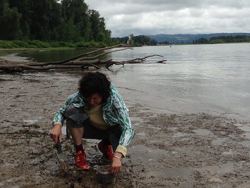
- Sauvies Island clay sampling (digging)
Back at PNCA, I’m using the ceramics studio to see if it’s usable, fireable, what it can do — if anything.
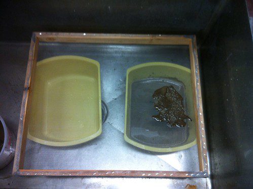
- Straining the mush to get rid of debris (thanks to awesome Liz Lux for help building the strainer frame!)
So that’s where I am. More to come as the clay does its thing.
+++
Update Aug 14
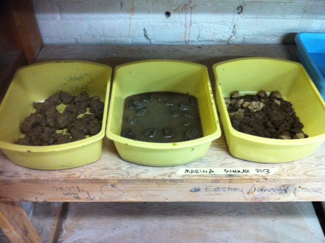
I processed all the clay samples from the four sites.
Willamette #2 I left as slip and Willamette #3 I had to amend with some Kentucky Old Mine #4 Ball (OM-4) clay, apparently from a mine in Kentucky.
I was told* that clay, in order to have any plasticity, must contain a variety of particle sizes or it will dry up and crack, as mine did when I laid it out on the plaster slab.But as slip, it is surprisingly adherent and is not cracking.
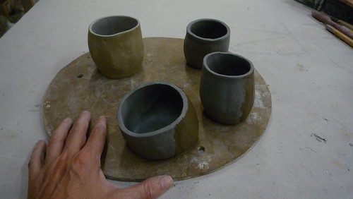
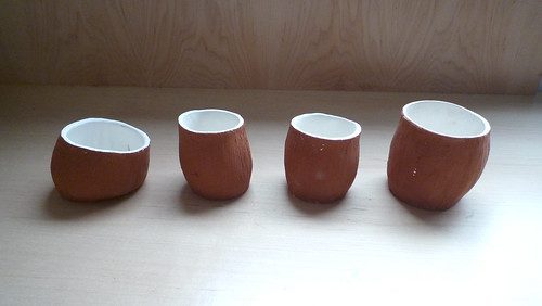
Here are 4 slab-rolled hand-built stoneware cups, coated with slip from Willamette site #2:
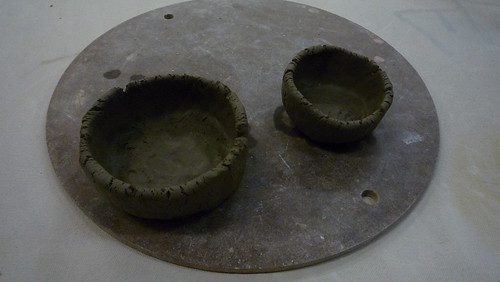
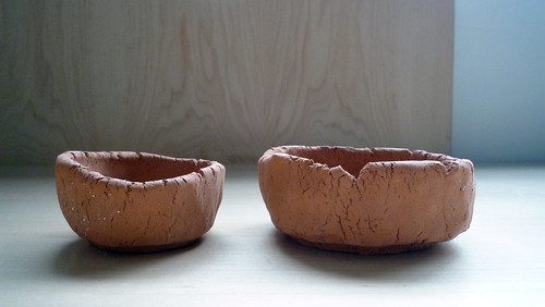
Here are 2 pinch pot containers made from the Willamette site#3 clay amended with 20% OM-4 Clay. Even with the added clay, it was still quite lifeless so I knew that slab rolling for hand-built cups was not going to end well:
Next step: firing.
One bisque fire (no 2nd firing):
They are much brighter red than you see here.
+ + + +
* More info on clay elasticity:
http://ceramicartsdaily.org/community/topic/3087-clay-elasticity-or-not/
“For a body to be really workable, you need particles of various sizes. Grog, while rated at a specific mesh size, actually has particles of many sizes.”
Some suggestions from this forum include adding ball clay, which is fine, urine, beer, and bentonite. -
August 7, 2013
boat, layers, clay

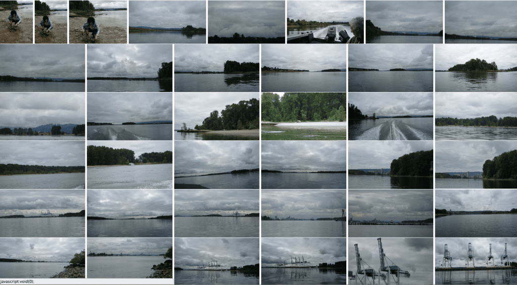
Hong Kong tanker on the Columbia, just north of the Port of Portland. Found a boat on Craigslist belonging to a retired lineman named Kent; he took me and Peter out from Cathedral Park, up through Multnomah Channel, around the top of Sauvie Island, down the Columbia along the south side of Hayden Island, down to Government Island, and back around Kelly Point to our start. Photos ins sequence can be found starting here on flickr.
My agenda was to start to get a sense of the usage overlays along the northeast and northwest sides of Portland, and also dip up just outside the city bounds, where agriculture is happening (on Sauvie Island). I also wanted to start experimenting with local clay, the river banks are full of it.
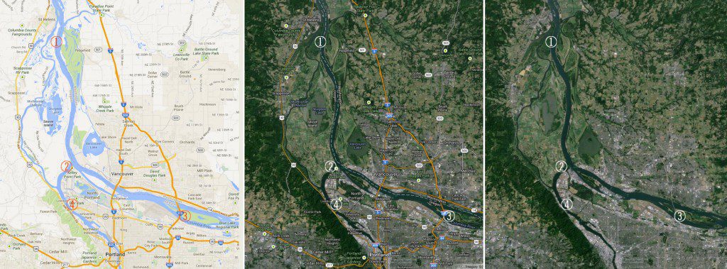
I sampled clay from the river banks at 4 spots:
1.
Lighthouse NE end of Sauvie Island
+45° 50′ 52.80″, -122° 47′ 20.52″2.
+45°38’53”, -122°46’3″
Kelly Point3.
+45° 34′ 18.75″, -122° 31′ 25.01″
Government Island4.
+45° 35′ 11.95″, -122° 45′ 45.44″
Cathedral Park5.
bond street sewer6.
linnton shoreline -
August 7, 2013
PDX: Terroir, OR what…
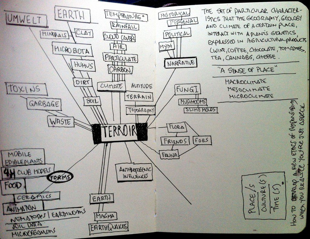
OK. I feel like I started this string of posts airdropped, as I was, in the middle with very little context. I won’t say the fog has cleared, but I do have some more thoughts to add. As I posted in July, I’m starting a new project in Portland Oregon. It’s a result of a multi-year Research Fellowship through the Pacific Northwest College of Art‘s Collaborative Design program. I am very grateful to the MFACD Chair, Peter Schoonmaker, Animated Arts’ Rose Bond, Academic Dean Mark Takiguchi, and Provost Greg Ware. I’m the guinea pig Research Fellow, and looking forward to it.
It is now week 3, time is flying it’s summer, it’s beautiful, people are away or slower, and so I have also had to slow down.
I’ve started several resource spaces to keep track of work in addition to this blog:
PDX maps
PDX history, geology and terroir
Soil Microorganisms
flickrMy premise is to make entirely new work, adopt new methods, work more closely with science advisors, and get to know a particular place over a much longer period of time than I am normally able. The rubric for this is to re-invest/ investigate the notion of Terroir. As I have been writing a lot of letters to possible mentors and contacts, I have been trying to refine what I mean, way in advance of any sure thoughts on the subject or my own output.
I’m posting this excerpt of a letter I wrote to a soil superstar in case anyone has any suggestions!
In short, I am starting work on a long-term project that focuses on Portland’s shoreline and waterway uses, as a way to explore local/global connections, and a variety of communities, both human and non-human.
I am keen to learn more about microbial soil communities, and their connection to larger systems of “terroir” (I would like to see that word applied to more than wine and fine commodity products). My current strategies include clay harvesting, and getting intimate with how soil works; I have many questions that are difficult for a lay person to access; information tends to be directed either to the gardener who needs to know a basic and general sense of soil composition, or to the professional and academic, which is very detailed and granular.
So here are my questions.
I’m looking for a soil biologist, preferably in the Portland area, who’d be interested and game to work with me on soil sampling, microvideography, and who has expertise they are wiling to share. I am not a pest or a flake in the least, I promise, and I absorb information pretty well.
The kinds of primary inquiries I am interested in knowing more about have to do with:
— the question of whether microbes can be/are speciated (I recently read that the tiny ones are not here), and how that impacts their study and status, so to speak.
— how site-specific are organismic communities? Do local and global factors have effect on specific communities?
I also want to map the northern end of Portland’s shoreline – its uses and abuses seem to range from wetland to swimming hole to superfund site to golf course to airport to speedway to houseboat enclave to recreational park to, of course, the Port of Portland.
-
-
-
July 28, 2013
A simple look at the characters in a soil ecosystem
The soil and the organisms living on and in it comprise an ecosystem. The active components of the soil ecosystem are the vegetation, fauna, including microorganisms, and man.
– Vegetation: The primary succession of plants that colonize a wethering rock culminates in the development of a climax community, the species composition of which depends on the climate and parent material, but which, in turn, has a profound influence on the soil that is formed. For example in the Mid-West of the U.S. deciduous forest seems to accelerate soil formation compared to grassland on the same parent material under similar climatic conditions. Differences in the chemical composition of leaf leachates can partly account for a divergent pattern of soil formation. For example acid litter of pines or heather favors the development of acid soils with poor soil structure, whereas litter of decidious trees favors the development of well structured soils.
– Meso-/Macrofauna: Earthworms are the most important of the soil forming fauna in temperate regions, being supported to a variable extent by the small arthropods and the larger burrowing animals (rabbits, moles). Earthworms are also important in tropical soils, but in general the activities of termites, ants, and beetles are of greater significance, particularly in the subhumid to semiarid savanna of Africa and Asia. Earthworms build up a stone-free layer at the soil surface, as well as intimately mixing the litter with fine mineral particles they have ingested. The surface area of the organic matter that is accessible to microbial attack is then much greater. Types of the mesofauna comprise arthropods (e.g. mites, collembola) and annelids (e.g earthworms, enchytraeids).
Table 3.2.1. Earthworm biomass in soils under different land use (White, 1987)
Earthworm biomass [kg/ha] Hardwood and mixed woodland: 370 – 680 Coniferous forest: 50 – 170 Pasture: 500 – 1500 Arable land: 16 – 760 – Microorganisms: The organic matter of the soil is colonized by a variety of soil organisms, most importantly the microorganisms, which derive energy for growth from the oxidative decomposition of complex organic molecules. During decomposition, essential elements are converted form organic combination to simple inorganic forms (mineralization). Most of the microorganisms are concentrated in the top 15 – 25 cm of the soil because C substrates are more plentiful there. Estimates of microbial biomass C range from 500 to 2,000 kg /ha to 15-cm depth (White, 1987). Types of microorganisms comprise bacteria, actinomycetes, fungi, algae, protozoa, and soil enzymes.
– Man: Man influences soil formation through his impact to the natural vegetation, i.e. his agricultural practices, urban and industrial development. Heavy machinery compacts soils and decreases the rate of water infiltration into the soil, thereby increasing surface runoff and erosion. Land use and site specific management (e.g. application of fertilizer, lime) also act on soil development.
– from Soil Morphology, Classification and Mapping, Dept of Soil Science, U. of Wisconsin-Madison
-
July 28, 2013
Report 7.28.13. Synergies, tiny and long
Yesterday I met with Heather Julius, who’s a bright star of a human, a researcher and chef who works with The Center for Genomic Gastronomy conceiving meals . These artists are kindred spirits. Heather’s knowledge of food nutrition, systems, and histories is deep, as is her info on the Missoula Floods and other deep time events, relations and natural histories that she researches for work as a natural sciences interpretive writer. I borrowed a book called Cataclysms of the Columbia, which could make a fine fine secret moniker for this project I am starting. Maybe.
One of the illuminating facts Heather mentioned is how corn made it to the Old World in the 16th century, minus the technology to make the corn’s niacin available to humans’ digestive systems. The missing ingredient was lime (calcium hydroxide), used to soak the corn in a process known as nixtamalization. If you live on corn, and don’t use lime, you end up with a niacin deficiency that manifests in extreme cases as pellagra, or, as this article says, you become a vampire:
After American corn (maize) was introduced to Europe, the food calories yielded per acre increased greatly over what had been provided previously by rye and wheatl2. The use of corn as a staple crop spread gradually from the Iberian Peninsula to eastern Europe9. At that time, where corn went pellagra was sure to follow, for cornmeal became the main source of energy for poor people. Although popularly observed and described in Spain and Italy, pellagra was uniquely macabre in eastern Europe, where poverty, cultural viewpoints, and a lack of medical knowledge kept the disease from being diagnosed until 18589. For years, an infectious or genetic cause was suspected, but pellagra is generally the consequence of a diet which relies upon corn as a staple because the niacin and tryptophan in corn are bound and have poor bioavailability. Clinically, the disease is identified by the ‘four Ds’-dermatitis, dementia, diarrhoea, and death.
– Pellagra and the origin of a myth: evidence from European literature and folklore, J S Hampl and W S Hampl, 3rd
JOURNAL OF THE ROYAL SOCIETY OF MEDICINE Volume 90 November 1997
PDF here+ + +
Another perspective Heather shared is how the Missoula Floods greatly enriched the soil base in Oregon, borrowing, snatching, ripping the soils from eastern Washington after the ice dams broke, and a roaring cascade of water, glacial silt, debris, rock, minerals, came rushing towards the sea along the Columbia and other water ways. That was only 10,000 years ago.
The Columbia River begins its flow through this Basin from Canada’s Rocky Mountain Range and eventually becomes the border between Oregon and Washington. Along the way, the Columbia is fed by a number of major tributaries. The three largest include the Kootenai, the Clark Fork-Pend Oreille and the Snake rivers. Others include the Payette, the Sultan, the Cowlitz, the Santiam and the Willamette. While each of these tributaries has its own unique characteristics, the Columbia River and the Basin represent the larger whole to which they are all connected.Over millions of years a series of cataclysmic events shaped the Basin’s topography. During the Eocene and Oligocene periods that date back 20 to 50 million years, there were tectonic shifts that helped form mountainous areas and volcanic activity that resulted in floods of molten lava. Seventeen million years ago, scientists believe a giant meteorite struck southeastern Oregon, causing floods of basalt lava. As this lava spilled across the western lowlands, the Columbia Plateau began to form. When the lava cooled and cracked, it formed vertical columns of basalt that are still visible today. These volcanic fires were followed by the deep freeze of the ice age.The big glaciers of the last ice age covered all the northern fringe of Washington and Idaho. In Washington, these glaciers advanced down the western part of the Okanogan Valley about as far south as Chelan. In Idaho, a finger of the ice sheet came down to Sandpoint, where it blocked the mouth of the Clark-Fork River. In so doing, an ice dam one-half mile high was created.This ice dam resulted in the creation of Lake Missoula, which was 2,000 feet deep and stretched hundreds of miles into Montana. Approximately the size of Lake Ontario, about 15,000 years ago the dam burst all at once and Lake Missoula was drained. As the resulting flood carved out 50 cubic miles of earth, deep channels were formed and areas such as the Columbia Gorge were further widened and shaped. It dug riverless canyons such as Dry Coulee, Spring Coulee and Moses Coulee in a matter of days. And it formed the Grand Coulee, which is fifty miles long, up to six miles wide and nine hundred feet deep.Floods also swept into Oregon, covering much of the Willamette Valley. Where Portland stands today, flood waters were thought to be 400 feet deep. Scientists now believe such floods occurred repeatedly as the continental ice sheet came and receded. With all these cataclysmic events, the Northwest’s topography took shape…As the hydrologic cycle occurs, 130 million acre feet of runoff flows through the topography of the Columbia river system annually. By comparison, that is more than eight times the runoff than the Colorado River System…In short, the Columbia River Basin is an essential reason for the Northwest being a dynamic and highly prosperous region within the nation and the world. Hydropower, flood control, irrigation, navigation and recreation are specific benefits that the uniqueness of the Basin and its river system provide.
– from the Foundation for Water & Energy Eduction
(this is a non-profit “committed to providing balanced information regarding the use of water as a renewable energy resource in the Northwest,” and whose FWEE Sponsorship Level Members include most if not all the hydroelectric power companies in the Columbia Basin, in addition to the US Army Corps of Engineers, US Bureau of Reclamation, and others)What is the connection between Hydro’s vested interest in the continue dominance of this form of power in the area, and an absence of the use of solar in, say, Facebook’s and Apple’s newly built server farms in the sage-steppe (high desert) of Prineville? Cheap hydro. Not solar. This made me very aware of hitting the “send” button on my me.com email on my smartphone, or checking in to Facebook. What’s powering that, and what’s its relation to the larger system of water, sun, energy, money, geography?
Data center energy use has become a hot topic in the Northwest and beyond because these massive server farms use huge volumes of electricity — as much as a small town — to power thousands of computers and to cool those long corridors of hardworking machines.Environmental groups are critical of projects that don’t use renewable energy, and power planners are watching closely to assess the impact of the Northwest’s burgeoning data center industry on regional power demand.Data centers are springing up across Oregon, drawn by tax breaks that exempt the facilities from property taxes. Those incentives can be worth tens of millions of dollars annually to large projects like Apple’s; the value of Apple’s exemptions will depend on how much it spends equipping the facility. While server farms employ relatively few people — Facebook employs just 70 at its massive facility in Prineville — they can make a big impact in small communities, especially during the labor-intensive construction phase.Apple needs new data centers to power its iCloud service, which stores its customers photos, music, calendars and other digital information uploaded from iPhones, iPads and iMacs.The company confirmed plans to build a data center in Prineville last year, just up the road from two massive Facebook buildings. Work began last fall on the first of two, 338,000-square-foot buildings on the bluff above town.Famously secretive, Apple has said little about the details of its project beyond what’s on file with city planners. It had said previously, though, that it would use only renewable energy for the facility. Today, it said that mix will include renewable sources “such as wind, hydro, solar, and geothermal power.”That apparently includes hydropower from the Bonneville Power Administration via the Central Electric Cooperative, a regional power agency serving the Prineville area. The CEC said this morning that it’s supplying electricity for Apple’s construction and is in talks to help power center operations.– Apple Outlines “Green” Energy PLans for Prineville Data Center (link)
Facebook has a Page for Prineville Data Center, with over 109,000 Likes, and a lot of local information.
This article from 4.29.13 on datacenterknowledge.com does a good general job of describing the transformation of rural landscapes like Prineville’s, called “The Cowboy Capitol of Oregon” (sic) on Facebook’s Prineville Data Center Page.
Your iTunes downloads, Facebook posts and YouTube videos travel through these small rural communities en route to your desktop and mobile device. The growth of the digital economy is not just reshaping how we use the Internet, but creating a new data center geography in which armadas of servers now reside in suburbs or rural towns, often outnumbering the humans in these communities.The economics of hyper-scale computing favor cheap land and cheap electricity, which are unavailable in many of the historic Internet hubs, which are located near major cities. This has created an unusual side effect – major data centers are transforming the economies of small towns around the U.S., placing them on the front line of the race to build out the infrastructure that runs the Internet.
-
July 28, 2013
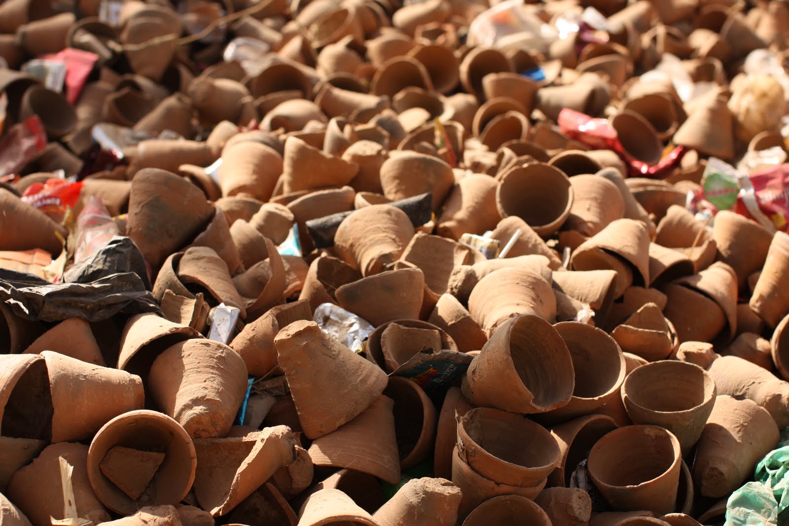
Disposable chai cups
Made all over India, single-use low-fired red clay cups are used by chai sellers in the street, then disposed, dissolved, returned.
I’m looking into how to do something similar in Oregon.
Not sure I can master off-the-hump throwing on the wheel at all, let alone one that’s manually operated by firing up a stick.
Here’s an example of technique from a master in Varanasi:
Are the clay sources each local to the potter’s city?
Does toxicity come into play (I’m thinking of the Ganges around Varanasi for instance)?
How much are plastic cups replacing clay?
How connected to class or nostalgia are these cups?
